
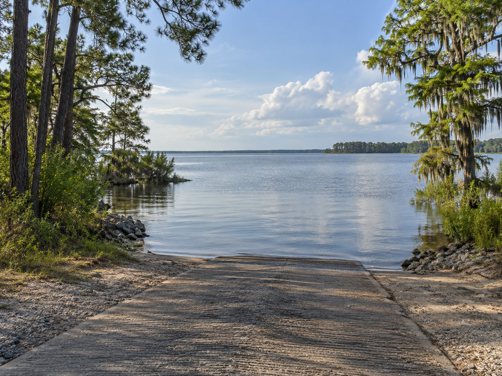
Thornley Forest II Landing is a verified public boat access on Lake Moultrie in the Moncks Corner area of Berkeley County, South Carolina. The current SCDNR boat-ramp dataset lists the site as open and both owned and maintained by Santee Cooper. This practical guide gives boaters and anglers the exact map point, official record identifiers, launch checks, fishing context, regulations and reservoir hazards to review before a trip.
Thornley Forest II Landing quick facts
- Official ramp name: Thornley Forest II
- Waterbody: Lake Moultrie
- County: Berkeley County, South Carolina
- Area: northwest of Moncks Corner
- Coordinates: 33.2188, -80.0300
- Owner and maintenance agency: Santee Cooper
- Current dataset status: Open
- SCDNR record: FID 97; Facility ID 8002
The primary source is the SCDNR Boat Ramps FeatureServer, verified September 5, 2026. An official SCDNR Moncks Corner-area location map also labels Thornley Forest II among nearby state boat ramps. The final map below uses the matching dataset attribute and geometry coordinates.
Directions and exact map point
Use 33.2188, -80.0300 as the navigation target and keep the coordinates available offline. The SCDNR location map places the landing northwest of Moncks Corner in the Thornley Forest II area. No dependable numbered street address was published in the official sources reviewed, so do not substitute an unverified commercial-directory address for the agency point.
Arrive in daylight for a first visit. Residential lake roads can have tight turns, limited shoulders and local traffic; slow down on the final approach and follow posted signs rather than assuming every road leading toward the water reaches the public ramp.
Launch and parking checks
- Walk the ramp before backing down and check for debris, algae, sand or a submerged drop-off.
- Confirm the water depth works for your trailer and boat.
- Stage equipment away from the launch lane.
- Park only in signed or clearly established areas and keep the turnaround open.
- Save a second verified Lake Moultrie access before leaving home.
The official records reviewed do not publish ramp-lane count, parking capacity, fees, operating hours, restrooms, lighting, a courtesy dock or an accessible boarding feature. Treat each of those details as unknown. The current “open” status does not override a gate, barrier, temporary maintenance notice or closure sign encountered at the site.
Boat access versus shore fishing
The verified SCDNR record establishes a boat ramp. It does not establish a public fishing pier, improved bank-fishing platform or unrestricted shoreline access. Anglers without a boat should not use an active launch lane as a fishing spot. Keep clear of backing trailers, follow posted rules and leave room for boats to launch and recover safely.
For boat anglers, this landing provides access to Lake Moultrie, but the safest route to a chosen fishing area depends on weather, water level, boat capability and knowledge of marked channels. A straight line on a phone map may cross stump fields or shallow water.
Lake Moultrie fishing possibilities
The SCDNR Lake Moultrie directory describes a 60,400-acre reservoir with largemouth bass, pickerel, bream, striped bass, blue catfish, flathead catfish and shellcracker fisheries. Those are lake-wide opportunities, not a claim that any species will be concentrated next to the ramp on a particular day.
Late-summer conditions can change with heat, wind, thunderstorms and water level. Check the current SCDNR freshwater fishing trends shortly before departure, then choose tackle and fishing areas that fit the latest conditions.
Licenses and regulations
Review the 2026–2027 South Carolina hunting and fishing regulations before fishing. Verify license requirements, species limits, size restrictions, lawful methods and any waterbody-specific rule for the fish you intend to target or keep.
Boaters should separately confirm registration, lighting and required safety equipment. On-site signs and lawful agency instructions control if they are more restrictive than a general statewide summary.
Stumps, channels and changing weather
Santee Cooper’s current lakes and navigation guidance warns that submerged trees, stumps and rocks can threaten unfamiliar boaters, particularly outside marked channels. Floating or nearly submerged logs may also drift into channels. Follow markers, use conservative speed and never tie to a channel marker.
- Wear a properly fitted personal flotation device.
- Check wind, lightning risk and lake data before launch and during the trip.
- Carry navigation lights, communication equipment and an offline map appropriate to the outing.
- Tell someone your route and expected return time.
- Head back early if weather, visibility or equipment condition worsens.
Nearby verified Lake Moultrie alternatives
Keep at least one backup landing in your plan. The Fred L. Day / Duckpond Landing guide covers a verified western-lake access near Cross. The Richardsons Landing guide, Augustus M. Flood Landing guide and Hatchery Landing guide document other open Lake Moultrie ramps with official coordinates.
Choose a backup by the water you intend to fish and a safe navigational route, not just the shortest drive.
A practical trip plan
- Recheck the SCDNR ramp record, weather, lake data and current regulations.
- Save 33.2188, -80.0300 and one backup landing.
- Inspect the approach, signs, ramp, water depth and parking layout on arrival.
- Stage away from the active launch lane.
- Use marked channels and conservative speed until you know this part of Lake Moultrie.
Bottom line
Thornley Forest II Landing is a verified open, Santee Cooper-owned and maintained Lake Moultrie access with an exact official map point. The available primary sources do not document every amenity, so arrive prepared, inspect conditions, keep a backup ramp and treat submerged timber and changing weather seriously.


Leave a Reply