
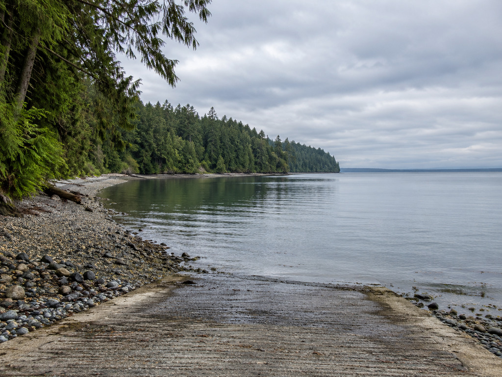
Freshwater Bay County Park offers a year-round concrete ramp and beach access about 10 miles west of Port Angeles, but Clallam County limits the launch to small boats 17 feet or shorter. The protected bay can look inviting while the Strait of Juan de Fuca beyond it remains cold, tidal and exposed. This guide covers the ramp, seasonal facilities, fishing rules and the practical checks to make before launching.
Explore more lakes, coastal walks and access guides in the Olympic National Park: A Practical Washington Guide.
Freshwater Bay quick facts
- Official site: Freshwater Bay County Park
- Address: 2298 Freshwater Bay Road, Port Angeles, WA 98363
- Coordinates: 48.1428910, -123.6396900
- Park size: 21.07 acres with 1,450 linear feet of public tidelands
- Launch: Concrete ramp for boats 17 feet or shorter
- Year-round area: Lower picnic site, launch ramp, portable toilet and beach access
- Seasonal area: Upper five-acre picnic area and upper restroom, May 15 through September 15
- Camping: Not allowed; this is a day-use park
Check the official Clallam County facility page for current park information.
Directions and park hours
From Port Angeles, follow State Route 112 west, turn north onto Freshwater Bay Road, and continue about three miles to the county park. Use the complete street address above rather than navigating only to the general bay name. The map at the end of this guide points to the official county address.
Clallam County’s day-use rules allow entry beginning one-half hour before sunrise and require visitors to leave by one-half hour after sunset. Overnight parking and camping are prohibited. Fires are allowed only in designated fire pits, beach fires are prohibited, and pets must remain controlled on a leash no longer than eight feet.
Launching a boat or kayak
The county describes Freshwater Bay as suitable for kayaks and small boats, with a firm maximum length of 17 feet. Treat that as an equipment limit, not a promise that every 17-foot rig will fit every tide or weather window. Inspect the ramp and water depth before backing down, organize lines and gear away from the active launch, and avoid blocking retrieval space.
Tidal height changes the amount of exposed beach and the usable water at the ramp. Check an official tide prediction and marine forecast before departure, then reassess conditions at the site. A quiet bay does not guarantee manageable wind, current or swell outside its protected water.
Parking and facilities
The lower park area provides the launch, beach access, picnic space and a portable toilet year-round. The upper wooded picnic area includes five secluded acres among western red cedar and ferns, plus an upper restroom, but those seasonal facilities are scheduled only from May 15 through September 15.
The county mentions an upper overflow parking area but does not publish space counts or a trailer-staging diagram. Arrive with the boat ready, respect posted restrictions and never assume a trailer space will be available. The facility page lists benches, picnic tables, a shelter and a fire pit; it does not identify fuel, potable water, fish cleaning or marina services.
Fishing in Marine Area 6
Freshwater Bay lies in WDFW’s Marine Area 6 — East Juan de Fuca Strait, which runs from Low Point east toward Point Partridge and Point Wilson. WDFW identifies salmon, halibut and lingcod among the area’s fisheries, but seasons, retention rules and legal gear vary by species and can change during the season.
Review the live emergency fishing and shellfishing rules and the current regulation pamphlet immediately before fishing. Emergency restrictions can change during the season, so do not use a general destination page as permission to retain any species.
Crabbing and tideland access
Clallam County lists crabbing among park activities, but the ramp and public tidelands do not guarantee that a crab or shellfish season is open. Check WDFW’s current crab-season page, licensing requirements and gear rules before setting pots.
For clams, mussels or other beach harvest, confirm both legal access and current health status. Use the Washington Department of Health Shellfish Safety Map on the day of the trip. A public beach can still be closed because of biotoxins or pollution.
Cold-water and wildlife safety
- Wear a properly fitted life jacket and dress for cold-water immersion, not only the air temperature.
- Check wind, tide, current, visibility and Strait conditions before leaving the protected bay.
- Carry navigation and communication equipment appropriate for saltwater boating.
- Give seals, whales, otters and other wildlife ample room; never pursue or feed them.
- Know your turnaround limits and keep enough reserve to return against changing wind or current.
- Do not exceed the county’s 17-foot boat limit.
Nearby alternatives
For another county-managed small-boat site farther west, compare the Pillar Point County Park guide. Anglers seeking a year-round WDFW concrete ramp with marina services nearby can review the Sekiu Water Access guide. For another Marine Area 6 launch, compare the tide-dependent Dungeness Landing guide.
Plan the trip
Freshwater Bay works best when the boat fits the county limit, the tide supports launch and retrieval, and the marine forecast matches the crew’s experience. Confirm the seasonal facility dates, WDFW regulations and same-day conditions before towing or carrying a boat down Freshwater Bay Road.
Planning more time outside? Visit the Outdoor Adventures shop.


Leave a Reply