
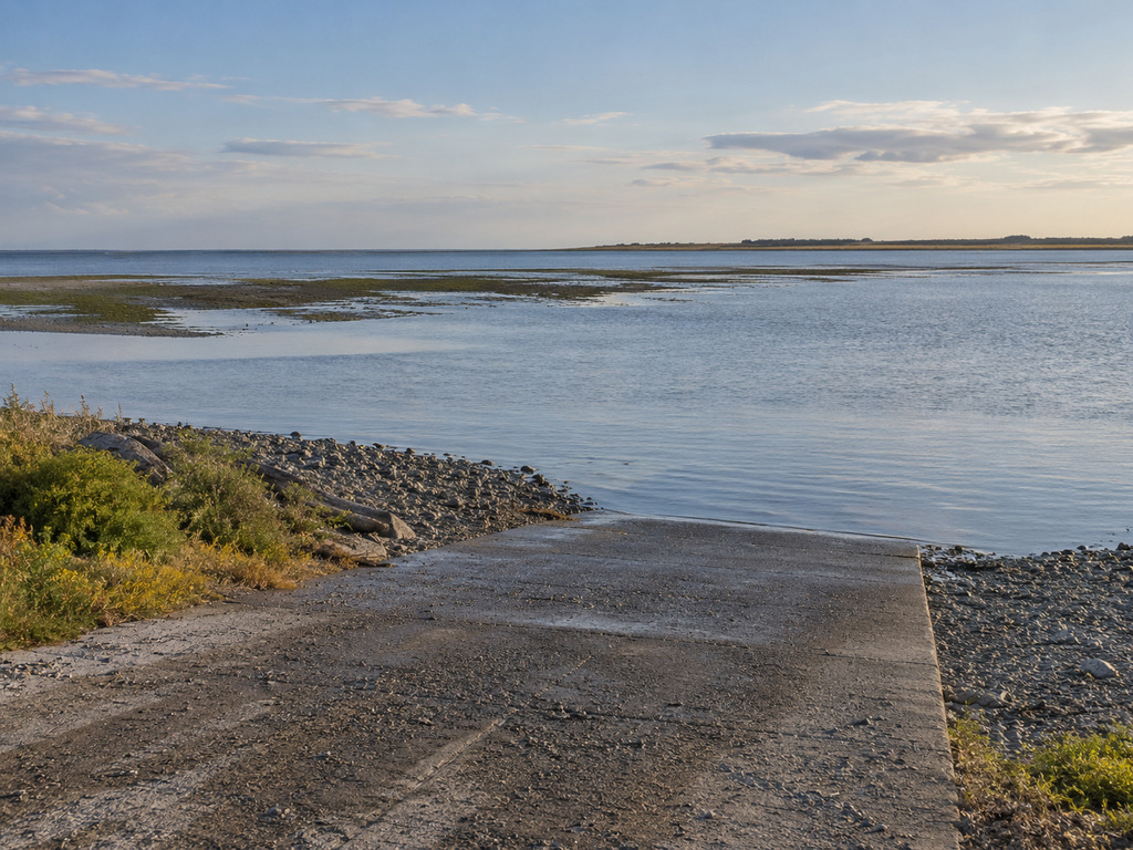
Dungeness Landing County Park provides a high-water boat launch, fishing access and a covered birding platform on outer Dungeness Bay, six miles north of Sequim. The key planning detail is the tide: Clallam County identifies this as a high-water launch, so it should not be treated like an all-tide marina ramp. This guide covers access, facilities, Marine Area 6 rules and a safe launch plan.
Dungeness Landing quick facts
- Official site: Dungeness Landing County Park
- Address: 298 Oyster House Road, Sequim, WA 98382
- Coordinates: 48.1512881, -123.1440416
- Setting: 5.6-acre county park with 13 acres of tideland on outer Dungeness Bay
- Boat access: High-water launch
- Facilities: Full-service restroom, picnic tables, benches and covered birding platform
- Other activities: Fishing, beach access and birdwatching
- Camping: Not allowed; this is a day-use park
Verify current park details on the official Clallam County facility page.
Directions from Sequim
From Sequim, drive north on Sequim-Dungeness Avenue for about six miles, turn right onto Marine Drive, then follow Oyster House Road as it bends right and drops toward the water. Use the complete 298 Oyster House Road address rather than a general Dungeness Bay pin. The final map below uses the county’s verified address.
Clallam County does not publish a parking-space count or detailed trailer-staging plan. Prepare the boat before occupying the launch approach, keep turning areas open and be ready to choose another access if the lot or ramp cannot safely handle your rig.
Why high water matters
The county specifically calls Dungeness Landing a high-water boat launch. Dungeness Bay contains broad tidelands, so falling water can leave shallow approaches and exposed ground between a trailer and navigable water. Check the tide curve—not only the day’s high and low times—and plan enough water for both launch and retrieval.
Before backing down, walk the ramp, confirm its usable end and assess the route into the bay. Account for your boat’s draft, trailer depth and the time you expect to remain on the water. A launch that works near high tide may be impractical several hours later.
Fishing and boating in Marine Area 6
Dungeness Bay is within WDFW’s Marine Area 6 — East Juan de Fuca Strait. WDFW identifies salmon, halibut and lingcod among the broader area’s fisheries, but seasons, open subareas, legal gear and retention rules vary. Some rules differ inside bays or near protected areas, so confirm the exact water you intend to fish.
As of September 9, 2026, WDFW’s emergency-rule system lists a Marine Area 6 Chinook-retention closure. Check the live emergency fishing and shellfishing rules and current regulation pamphlet immediately before departure. A public launch does not mean every fishery is open.
Tidelands and shellfish checks
The park includes 13 acres of tideland, but public access alone does not authorize harvest. Before taking clams, oysters, mussels or crab, verify the current WDFW season, license, species rules and exact boundary. Refuge protections and private tidelands elsewhere around Dungeness Bay can create additional restrictions.
Also check the Washington Department of Health Shellfish Safety Map on the day of the trip. A beach may be physically accessible while harvest is closed because of biotoxins or pollution.
Birding platform and facilities
The covered birding platform is one of the park’s defining features. Clallam County describes it as having easy access, and the outer-bay position can support views across the tidelands and toward the distant Dungeness Lighthouse. Bring binoculars and avoid entering sensitive habitat or disturbing resting and feeding birds.
The county lists a full-service restroom, benches and picnic tables. It does not publish detailed accessibility measurements for the launch, tideland route or restroom, so visitors who need a specific slope, surface or transfer space should contact Clallam County Parks before traveling.
Day-use rules
- Enter no earlier than one-half hour before sunrise and leave by one-half hour after sunset.
- No overnight parking or camping.
- Beach fires are prohibited; use fires only in designated fire pits where provided.
- Keep pets controlled on a leash no longer than eight feet and clean up after them.
- Pack out garbage.
- Hunting and projectile weapons are prohibited in county day-use parks.
Cold-water and shallow-bay safety
- Wear a properly fitted life jacket and dress for cold-water immersion.
- Check tides, wind, visibility and the Marine Area 6 forecast before launching.
- Carry navigation and communication equipment appropriate for saltwater.
- Watch the depth continuously and avoid grounding on exposed or submerged tidelands.
- Give wildlife and protected areas ample space.
- Set a return time that preserves enough water at the high-water ramp.
Nearby alternatives
For a year-round concrete ramp west of Port Angeles with a verified 17-foot boat limit, see the Freshwater Bay County Park guide. Farther west, the Pillar Point guide covers another county small-boat ramp, while the Sekiu Water Access guide covers a distinct WDFW ramp in Marine Area 5.
Dungeness Spit and its refuge trail are a separate destination with separate access rules; Dungeness Landing is useful for bay access and viewing, not as a shortcut to the refuge trailhead.
Plan the launch window
Build the trip around a suitable tide rather than arriving and hoping the ramp works. Confirm county access, current WDFW rules, shellfish health status and marine conditions, then preserve enough high water for a safe retrieval at 298 Oyster House Road.


Leave a Reply