
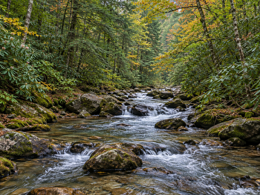

Noontootla Creek rewards careful trip planning before the first cast. This wild-trout water in Georgia’s Blue Ridge Wildlife Management Area has an artificial-lures-only rule, a 16-inch minimum length for mountain trout and a mix of public National Forest and private reaches. Three Forks on Forest Service Road 58 is the clearest public-land navigation point for understanding the upper watershed.
Why Noontootla Creek is different
Georgia DNR identifies the Noontootla Creek watershed as a high-quality fishery for wild brown and rainbow trout, with some tributaries offering a chance at wild brook trout. The agency also classifies Noontootla Creek and its tributaries as special-regulation water: anglers may use artificial lures only, and mountain trout under 16 inches may not be taken from the creek or its tributaries within Blue Ridge WMA.
That combination creates a precise fishing intent, but not a guarantee of an easy day. The upper watershed is small, cold mountain water. Approach pools quietly, keep casts compact around streamside vegetation and handle any released trout with wet hands and minimal air exposure.
Start with the public-land boundary
The U.S. Forest Service’s Noontootla FSTopo map shows Noontootla Creek, Forest Service Road 58, Three Forks and the surrounding Blue Ridge WMA and National Forest lands. The Forest Service’s older river evaluation describes a 9.7-mile segment beginning at Three Forks, with both National Forest and private mileage. That is the key planning point: public access in one reach does not make every downstream bank public.
- Navigation point: Three Forks, where Forest Service Road 58 crosses the Appalachian Trail near the headwaters.
- Public-land context: Blue Ridge WMA is U.S. Forest Service property; Georgia DNR manages hunting while the Forest Service manages roads and general recreation.
- Private-property rule: confirm land ownership before leaving clearly mapped public land, and never cross posted or fenced property without permission.
- Map to carry: download the official Forest Service Noontootla FSTopo map before losing service.
The Appalachian Trail Conservancy’s Three Forks directions reach the crossing by Forest Service roads and warn that those roads can be rough or impassable in winter or very wet weather. It recommends contacting the Forest Service ranger district for current conditions. Do not treat an online route as proof that a gate is open on the day of your trip.
Licenses and the special trout rules
Anglers age 16 or older need both a Georgia fishing license and a trout license. At Noontootla Creek and its tributaries on Blue Ridge WMA, use only artificial lures. Georgia’s fishing rule also makes it unlawful to take or possess mountain trout under 16 inches from these waters.
A 16-inch minimum is not the same as a catch-and-release-only rule. If considering harvest of a legal fish, check the current statewide creel limits and every posted instruction first. Regulations can change, and signs at the water take precedence over a trip guide. Review the Georgia DNR trout page and interactive stream map together with the current 2026–2027 regulations immediately before fishing.
A practical approach for small wild-trout water
- Choose compact artificial flies or lures that you can control around rhododendron and low branches.
- Fish upstream when practical so you approach trout from behind their field of view.
- Work the edges of current seams, pockets behind rocks and the heads and tails of pools.
- Release sub-16-inch trout immediately and avoid dragging fish onto dry rocks.
- Move on after a few careful presentations rather than repeatedly disturbing a small pool.
- Pack out clipped line and damaged tackle; leave streamside plants and woody cover in place.
The creek’s appeal is the possibility of naturally reproducing trout in a shaded Southern Appalachian setting. Water temperature, flow, recent rain and angling pressure still control the day. During warm conditions, carry a thermometer and stop fishing if handling trout safely becomes doubtful.
Roads, parking and facilities
Forest Service Road 58 is a forest-road approach, not a developed state-park entrance. Use only established pull-offs that leave room for emergency and administrative traffic. Never block a gate, road or trail crossing. The official sources reviewed for this guide do not provide a parking-space count, restroom guarantee, drinking-water source or accessible fishing platform at Three Forks, so plan for a primitive visit.
Georgia DNR’s land-access chart lists Blue Ridge WMA as U.S. Forest Service property and says a land-access license is not required simply to enter this property. Fishing licenses and trout privileges are still required when fishing. The WMA page also states that ATVs and UTVs are not allowed on Forest Service roads unless a route is specifically designated for them.
Safety and seasonal conditions
Slippery rocks, cold water, steep banks, falling limbs and changing road conditions are the main practical hazards. Rain can raise a small mountain creek quickly, while freeze-thaw cycles and storms can make unpaved roads difficult. Turn around before a road or crossing exceeds your vehicle, experience or comfort level.
Blue Ridge WMA also supports hunting. During open seasons, wear highly visible clothing, avoid active hunting areas and never interfere with hunters. Check the Georgia DNR alerts and closures page and the linked Forest Service alerts shortly before departure. The DNR page reviewed for this guide was updated September 28, 2026 and did not list a Blue Ridge-specific closure, but conditions may change.
Nearby North Georgia alternative
If rough forest roads or small-water fishing are not the right fit, the Toccoa River tailwater at Tammen Park offers a clearly addressed public starting point below Blue Ridge Dam. It is a different fishery with dam-release hazards, so check TVA generation information before entering that water.
Official planning links
- Georgia DNR: trout fishing, special-regulation waters and trout stream map
- Georgia Secretary of State: current fishing regulations
- Georgia DNR: Blue Ridge Wildlife Management Area
- Georgia DNR: WMA land-access chart
- U.S. Forest Service: Noontootla FSTopo map


Leave a Reply