
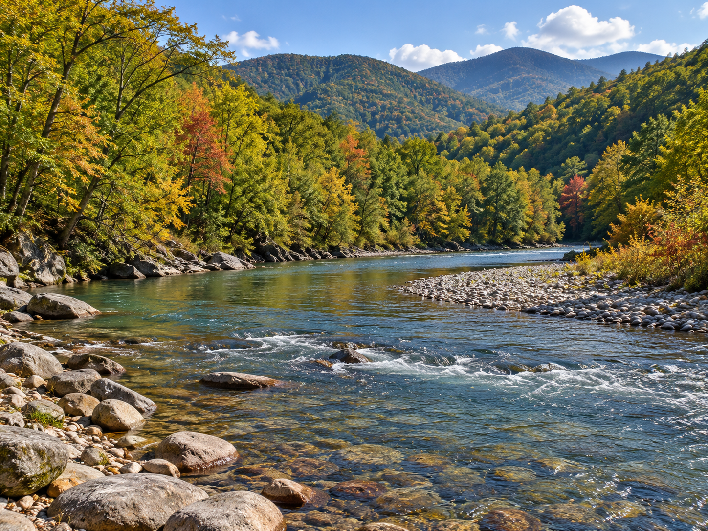
Deep Hole Recreation Area pairs a small campground with day access to the Toccoa River just north of Suches in Georgia’s Blue Ridge Mountains. The official Forest Service page and Recreation.gov listing identify fishing, paddling, tubing, kayaking and picnicking here, with nine campsites and river access close to the campground loop. This guide focuses on what the current agency pages confirm, and flags details visitors should recheck before driving into the mountains.
Where is Deep Hole Recreation Area?
Deep Hole is in the Chattahoochee National Forest on the Toccoa River, north of Suches and south of Blue Ridge. Recreation.gov lists the visitor address as 27088 Morganton Highway, Suches, GA 30572. The Forest Service’s Blue Ridge Ranger District page currently marks the recreation area open and describes it as a small campground on a broad river bend.
Directions, parking and day use
From Dahlonega, the Forest Service directs visitors north on Georgia Highway 60 for about 13 miles, then right onto Forest Service Road 654 and about one mile to the campground. From Blairsville, the agency route uses U.S. 19/129, Georgia Highway 180, then Georgia Highway 60 and FSR 654. From Blue Ridge, Recreation.gov directs drivers through Morganton on Highway 60. Check the live agency directions and forest alerts before leaving; mountain road conditions and closures can change.
There is a designated day-use area and a campground loop. Recreation.gov lists a $5 per vehicle day-use fee for visitors not staying overnight; the Forest Service page lists camping at $15 per site per night. Fees can change, so confirm the current amount and payment instructions before arrival. The Forest Service says the campground is open 24 hours, quiet hours are 10 p.m.–6 a.m., and a campsite is limited to two vehicles. Its page directs campers to reserve before arrival and says reservations cannot be made on site. Check the exact campsite and dates in the current booking listing because availability and booking details are site-specific.
Fishing and river access
Fishing is an official activity at Deep Hole, and the Recreation.gov listing describes immediate access to the Toccoa River. Its facility information lists nine campsites, with sites 5 and 9 directly beside the river, and identifies a fishing pier within walking distance of the campsites. Georgia DNR’s accessible trout-site directory also identifies a fishing platform at Deep Hole and provides the GA-60 and recreation-area access route. The same listing says the nearby Chattahoochee National Fish Hatchery stocks this area with trout weekly during the peak camping season. Stocking schedules and river conditions vary; check Georgia DNR’s current trout information rather than assuming a particular species, catch, or stocking date.
Anglers age 16 and older need a current Georgia fishing license, and a trout license is required to fish for or possess mountain trout. Review the Georgia DNR fishing resources and the current 2026–2027 regulations guide for the water-specific rules, seasons, limits and tackle requirements. The pages reviewed for this guide do not establish that the Deep Hole reach itself is delayed harvest, so don’t apply another Toccoa reach’s special rules here without checking the current regulation listing.
Paddling the Toccoa Canoe Trail
Recreation.gov identifies Deep Hole as the start of the Toccoa River Canoe Trail, a 13.8-mile moderate paddle to the takeout at Sandy Bottoms Recreation Area. The Forest Service lists canoeing and boating among the area’s recreation opportunities. That mileage is a route description, not a promise of safe flow or a guaranteed trip time: check water and weather conditions, plan a vehicle shuttle, wear a properly fitted personal flotation device, and do not launch when conditions exceed your group’s skill or equipment.
Campsites, facilities and accessibility
The campground has nine standard nonelectric sites. Recreation.gov identifies sites 5 and 9 as directly beside the river. It lists one double vault toilet near the loop, no potable water, electrical hookups or dump station, and limited cell service in some locations. The Forest Service page confirms that potable water is not available, but its restroom field says information is unavailable. Because the two official listings differ on restroom detail, confirm current facility status with the ranger district if it affects your plans. Bring drinking water and expect a basic, self-service campground rather than full hookups.
The Forest Service listing does not provide an accessibility audit for the route from parking to the river or campsite surfaces. Contact the Blue Ridge Ranger District before travel if you need specific information about grades, accessible parking, restroom access or the fishing pier approach. Leash dogs, follow posted fire rules, keep food secured, and pack out trash; the official campground notices emphasize bear awareness and responsible food storage.
When to go and nearby alternatives
The Forest Service lists Deep Hole as open year-round. Fall brings changing hardwood colors in North Georgia, while the Recreation.gov page notes trout stocking during the peak camping season. Before any trip, check the Chattahoochee-Oconee National Forest alerts, weather, river conditions, and the current DNR rules. Recreation.gov names Cooper Creek and Rock Creek as nearby alternatives; our Cooper Creek WMA guide covers another North Georgia fishing-and-camping option. For a different section of the Toccoa, see our guides to the Shallowford-to-Sandy Bottoms delayed-harvest reach and Tammen Park access below Blue Ridge Dam; their regulations and access are not interchangeable with Deep Hole.
Before you go: verify the open status, road approach, fees, campsite booking, facilities, river conditions and current fishing regulations with the official pages linked above. The campground has no potable water, and cell service may be limited.
For outdoor-inspired gear connected to your next trip, visit the Outdoor Adventures shop.


Leave a Reply