
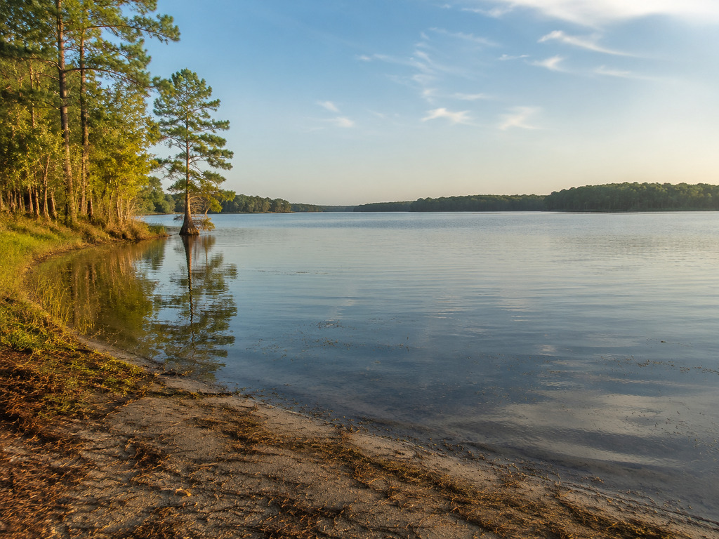
Spiers Landing is an officially listed public boat access on Lake Marion in Berkeley County, South Carolina. The state record identifies Santee Cooper as the owner, Berkeley County as lessee and maintainer, and the access as open. This guide keeps the focus on verified access details, fishing conditions and the lake hazards that matter before launching.
Spiers Landing quick facts
- Official access name: Spiers
- SCDNR facility ID: 8009
- SCDNR feature: FID 104
- Water: Lake Marion
- County: Berkeley County
- Owner: Santee Cooper
- Lessee and maintainer: Berkeley County
- Current dataset status: open
- Official coordinates: 33.3964, -80.1975
- Road: Spiers Landing Road, Cross, South Carolina
The details above come from the SCDNR Boat Ramps FeatureServer. The exact record carries GlobalID 245dbb1d-54d7-471b-965f-8d828d41ff29. Berkeley County also lists Spiers Landing among the landings its Roads and Bridges department inspects, maintains and repairs.
Where is Spiers Landing?
Spiers Landing is on Lake Marion in the Cross area of Berkeley County. Berkeley County documents the landing on Spiers Landing Road, while the state dataset supplies the precise pin at 33.3964, -80.1975. Save those coordinates before leaving reliable service and compare the arrival point with posted signs.
The official record calls the access “Spiers,” while county materials use “Spiers Landing.” Both names refer to the same Lake Marion facility. The coordinate pin is more dependable than relying on an unverified street number.
Launching and parking
SCDNR includes Spiers in its boat-ramp inventory and currently marks it open. Berkeley County’s Roads and Bridges page confirms county maintenance responsibility. Neither source specifies the ramp surface, number of lanes, parking capacity, dock arrangement, lighting, restrooms, launch fees or accessible features.
Arrive in daylight on a first visit and inspect the approach, turnaround, ramp and water depth before backing a trailer. Prepare the boat away from the active lane, park only where signs allow and keep gates and local traffic clear. An official “open” status does not guarantee that the ramp will suit every trailer, boat draft or lake level.
- Use a spotter and wheel chocks when backing.
- Install the drain plug and ready lines and safety gear before entering the ramp lane.
- Check the submerged end of the ramp during low water.
- Do not assume bait, fuel, potable water or restrooms are available.
- Save a verified alternate access before towing to the lake.
Fishing Lake Marion from Spiers
Spiers is documented as a boat access, not as a shore-fishing pier. SCDNR describes Lake Marion habitat that supports largemouth bass, crappie, bream, catfish and pickerel, with striped bass also part of the broader Santee Cooper fishery. Flooded timber, cypress, sloughs and aquatic vegetation create productive cover as well as serious navigation hazards.
For a current starting point, review SCDNR’s freshwater fishing trends. The September 2026 report says bass activity is improving as water cools, crappie are beginning a seasonal transition, and anglers continue to find bream and catfish. Treat that as reservoir-wide context rather than a guarantee at one landing.
Match tackle and boat control to the cover and weather. A trolling motor, depth finder and dependable anchor can help, but unfamiliar water still deserves idle speed. Avoid running a memorized route when water level, floating debris or visibility has changed.
Licenses and current regulations
Check the 2026–2027 South Carolina Hunting and Fishing Laws and Regulations before the trip. Confirm the license required for each angler and the current seasons, size limits, creel limits and legal methods for the species you plan to target. Rules can change independently of the boat-ramp listing.
Boaters must also meet current registration, lighting, life-jacket and safety-equipment requirements. Carry a properly fitted PFD for every person and keep required gear immediately accessible.
Lake Marion navigation and weather safety
Lake Marion was impounded without complete clearing. SCDNR warns of thousands of stumps, dead trunks and live cypress. These hazards can be just below the surface, especially away from marked routes or when water levels change.
Santee Cooper’s lake guidance recommends using marked navigation channels when possible, observing buoys and exercising extreme caution outside marked channels. Floating logs can also move into a route that looked clear on an earlier visit.
- Check the forecast and current lake information before departure.
- Slow down in unfamiliar or shallow water and assign a dedicated lookout.
- Keep clear of navigation markers and active channels when anchoring.
- Leave a float plan with your launch point and expected return time.
- Head ashore when thunder is nearby; Lake Marion can build a steep wind chop.
- Carry drinking water, sun protection, first-aid supplies and a charged communication device.
Seasonal trip planning
Late summer can be hot, humid and stormy, making early starts more comfortable. Autumn often brings cooler fishing conditions and shorter daylight. In winter and early spring, cold-water exposure makes a capsize much more dangerous even when the air feels mild.
Water level can affect ramp usability, shoreline obstacles and clearance above submerged timber. Check Santee Cooper’s lake information before towing to Spiers, then reassess conditions at the ramp rather than relying on an older report.
Facilities and accessibility
The official sources reviewed do not document restrooms, drinking water, lighting, a fishing pier, an accessible dock, designated accessible parking or a continuous accessible route at Spiers Landing. Visitors who require a particular facility should contact Berkeley County before travel or choose an access with published accessibility details.
Rural reservoir access can mean variable cell service and longer emergency response. Download directions, tell someone where you launched and follow every posted restriction. For emergencies, call 911.
Nearby Lake Marion alternatives
- Cathead Landing is another Santee Cooper-owned open access with an exact state dataset record.
- Santee State Park has two documented ramps, an accessible fishing pier, camping and trails.
- Low Falls Landing provides another public upper-Lake Marion launch option.
- Taw Caw Creek Park combines a boat ramp with documented fishing piers and a boardwalk.
- Pack’s Landing is useful when bait, fuel, guide services or Palmetto Trail access matter.
Plan the Spiers Landing visit
Spiers Landing answers a specific trip-planning need: an officially documented, currently open Lake Marion boat access maintained by Berkeley County. Navigate by the verified coordinates, arrive with daylight, inspect the ramp and parking situation, and launch only when the conditions match your boat and experience. Check current fishing rules and reservoir information before leaving home.
Access, fishing and regulation information verified September 3, 2026. Status, water level, ramp condition and local restrictions can change; follow posted signs and current official guidance.


Leave a Reply