
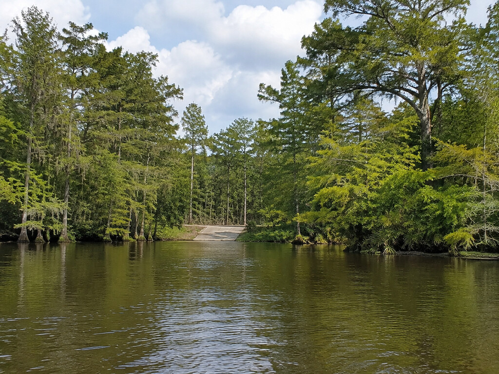
Wilsons Landing is a narrow, practical public-access destination on the Santee River below Wilson Dam in Berkeley County, South Carolina. The official SCDNR boat-ramp dataset lists the landing as open, owned and maintained by Santee Cooper. It is not a Lake Marion boat ramp: the agency record identifies the waterbody as the Santee River, and Santee Cooper’s current lake-data guidance specifically refers to spillway operations at Wilsons Landing.
Wilsons Landing quick facts
- Official access name: Wilsons
- Waterbody: Santee River below Wilson Dam
- County: Berkeley County
- Owner and maintainer: Santee Cooper
- Current dataset status: open
- SCDNR record: FID 112, FacilityID 8017
- Navigation pin: 33.4120, -80.1487
- Primary use: boat launching and river fishing access
- Facilities, parking capacity and accessibility: not specified in the official record; verify on arrival
Exact location and how to navigate
Use the coordinate pin at the end of this guide rather than relying on a broad “Wilsons Landing, SC” place label. SCDNR’s latitude and longitude attributes place the access at 33.4120, -80.1487. The FeatureServer’s stored map geometry does not match those attribute coordinates, so this guide uses the agency’s explicit latitude and longitude fields and flags the discrepancy instead of presenting false precision.
Download the route before entering the lower Santee floodplain, arrive in daylight and watch for posted access signs. The official record does not publish a street address, approach-road condition, number of parking spaces, ramp lanes, dock configuration, restroom availability or ADA features. Bring a backup plan and do not block a turnaround or launch lane while checking conditions.
Public-access status and what “open” confirms
The SCDNR Boat Ramps FeatureServer is the primary source for this page. Its Wilsons record identifies Santee Cooper as both owner and maintainer and marks the site open. That supports current public-access planning, but it does not guarantee a particular ramp surface, water depth, parking capacity, operating schedule or service level on the day you arrive.
Check posted signs before launching. Temporary closures can follow flooding, storm damage, maintenance or unsafe river conditions. If a barrier or closure notice conflicts with the online record, follow the on-site restriction.
Spillway releases are the defining hazard
Wilsons Landing sits below Wilson Dam, where Santee Cooper can release water through the spillway. Its current lake-data page explains that notifications are available when spillway discharge at Wilsons Landing increases or decreases. A change in release can alter current speed, water level, debris movement and the difficulty of returning to the ramp.
- Review current lake and discharge information before towing to the landing.
- Never approach spillway structures, restricted zones, warning signs, buoys or turbulent water.
- Wear a properly fitted life jacket and attach the engine cutoff switch when applicable.
- Expect floating debris, changing current seams and limited reaction time near shore.
- Do not launch when river conditions exceed your boat, motor or experience.
Boat choice, launch checks and parking
Because the official entry does not document ramp material or water depth, inspect the launch before backing down. Look for mud, algae, broken pavement, submerged edges, debris and a strong cross-current. Confirm that your tow vehicle can retrieve the boat under the conditions you see, not the conditions you expected.
Small craft still need conservative judgment. A sheltered-looking bank can open quickly into current affected by releases. Paddlers should have a realistic upstream return plan or a legal, prearranged shuttle; an easy downstream start can become a difficult or impossible paddle back.
Fishing the Santee River below Wilson Dam
This is a river-access page rather than a promise of a particular catch. Fish location and safe boat positioning can change with flow, temperature and season. Use current conditions to decide whether to fish current breaks, deeper edges or calmer water away from hazardous structures. Do not anchor where a release change could place the boat in stronger current.
Before fishing, review the current SCDNR regulations for licenses, freshwater limits, boating rules and any waterbody-specific provisions. Rules can change between seasons, and migratory species or protected fish may require special attention. Carry the current guide rather than relying on an older summary.
Seasonal planning
- Late summer: Plan around heat, afternoon thunderstorms and tropical-weather forecasts. Carry more drinking water than expected and avoid exposed ramp work during lightning.
- Fall: Cooler weather can improve comfort, but shorter daylight makes an unfamiliar return harder. Mark the ramp before leaving it.
- Winter: Cold-water immersion becomes a serious risk even on mild days. Dress for water temperature and keep dry layers protected.
- Spring: Higher basin inflows can change spillway operations, current and debris. Recheck discharge information close to departure.
Facilities and accessibility
SCDNR’s structured record does not confirm toilets, potable water, lighting, a courtesy dock, fish-cleaning facilities, trash service or accessible parking. Plan for a basic access point and pack out everything you bring. Visitors who need a specific slope, transfer surface or accessible route should verify it directly before travel.
Nearby Santee Cooper alternatives
Wilsons Landing serves a different waterbody and trip plan than the lake launches already covered in this cluster. For Lake Marion, compare Spiers Landing, Cathead Landing and Santee State Park. For Lake Moultrie, use the Amos Lee Gourdine / Russellville Landing guide. Those alternatives avoid treating the lakes and the river below Wilson Dam as interchangeable.
Bottom line
Wilsons Landing is an officially listed open Santee Cooper access on the Santee River, with a useful low-competition trip-planning intent and one unusual planning requirement: spillway operations matter. Navigate to the verified coordinate fields, inspect the ramp and parking situation in daylight, check current releases and posted restrictions, and keep a lake-launch alternative ready if river conditions are unsuitable.
Access, ownership, waterbody and spillway information verified September 3, 2026. Online status does not replace posted closures, current discharge information or an on-site safety assessment.


Leave a Reply