
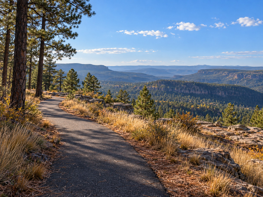

Rim Lakes Vista Trail offers an unusually straightforward way to experience Arizona’s Mogollon Rim: start from a paved parking area, follow a paved forest path, and reach broad views without committing to a rugged backcountry route. The current U.S. Forest Service trail record describes about 2.5 paved miles from just west of Military Sinkhole to Mogollon Campground, open to hikers and bicyclists.
This guide focuses on the practical details that matter before you go—where to park, what the trailhead does not provide, how to plan an out-and-back distance, and why weather and exposed rim edges deserve serious attention.
Rim Lakes Vista Trail quick facts
- Official trail: Rim Lake Vista Trail #622
- Best documented access: Mogollon Trailhead, just east of Mogollon Campground on Forest Road 300
- Surface: paved for about 2.5 miles from just west of Military Sinkhole to Mogollon Campground
- Uses: hiking and bicycling
- Route style: point-to-point segment unless you arrange a shuttle; most visitors should plan an out-and-back
- Trailhead facilities: paved parking; no restroom and no potable water at Mogollon Trailhead
- Managing agency: Apache-Sitgreaves National Forests, Black Mesa Ranger District
Where to park and how to find the trail
The clearest official access point is Mogollon Trailhead. It sits within Mogollon Campground, while day visitors can use the paved parking area immediately east of the campground along Forest Road 300. The Forest Service lists the trailhead at 34.321, -110.953.
Forest Road 300 meets Arizona Highway 260 opposite the Mogollon Rim Visitor Center. Navigation apps can mislabel dispersed pullouts along the rim, so use the official trailhead coordinates for the map pin and watch for Forest Service signs once you leave the highway.
Do not arrive expecting a full-service trailhead. The current Forest Service listing says there is no restroom and no potable water at Mogollon Trailhead. Bring all the water you need and handle restroom stops before reaching the parking area. Nearby campgrounds and lake facilities may operate seasonally and should not be treated as guaranteed trailhead services.
How far should you walk?
The Forest Service currently describes roughly 2.5 paved miles from just west of Military Sinkhole to Mogollon Campground. Walking the entire documented paved portion and returning to the same vehicle is therefore about five miles. You do not need to cover all of it: a shorter out-and-back lets you choose a turnaround based on weather, daylight, mobility and comfort near the rim.
An older Forest Service accessibility project summary says reconstruction linked previously surfaced trail near the overlooks with Mogollon Campground and provided more than three miles of accessible rim travel. Because official descriptions use different endpoints and figures, this guide uses the current trail record’s 2.5-mile paved segment for trip planning rather than presenting a longer number as exact.
Accessibility and surface conditions
Pavement removes many of the loose-rock and route-finding challenges common on Mogollon Rim trails. The Forest Service reconstruction summary explains that the trail was widened and paved to improve access for people of varied abilities. That history is useful, but it is not a promise that every present-day section meets every visitor’s needs.
Grades, cracks, pine needles, ice, storm debris and temporary maintenance can change the usable surface. Wheelchair users and anyone with limited mobility should contact the Black Mesa Ranger District at the number on the official trailhead page for current conditions and assistance needs. The paved parking area provides a practical starting point, but the exposed rim environment still requires conservative planning.
Views, forest and nearby water
The route follows a high forest landscape dominated by ponderosa pine and opens toward the layered, forested slopes below the Mogollon Rim. It is a scenery-first outing rather than a lake-shore walk. Rim Lakes Vista itself is an overlook destination; Woods Canyon Lake lies nearby in the broader recreation area but is a separate trip-planning target.
If you want to pair the walk with water access, use the site’s Woods Canyon Lake boat ramp and fishing access guide. For another paved-road lake option along Highway 260, compare the Willow Springs Lake access guide. Save the Knoll Lake guide for a more remote road-and-lake day.
Season and current-condition planning
The Forest Service page listed Mogollon Trailhead open when checked on October 6, 2026. That status can change quickly with snow, wildfire, prescribed fire, road work or storm damage. Check the Apache-Sitgreaves alerts page on the day of your trip and confirm Forest Road 300 conditions after major weather.
Nearby developed campgrounds commonly use a spring-to-fall operating season, but trail access and campground operations are not the same thing. A closed restroom, campground gate or concession does not automatically answer whether the trail is open. Use the trailhead status and forest alerts as the authoritative checks.
Safety on the Mogollon Rim
- Stay back from exposed edges. Rock shelves can be undercut, loose or slick, and not every viewpoint has a barrier.
- Leave the rim when thunder builds. The Forest Service specifically flags lightning as a major hazard in this landscape. Do not shelter beneath an isolated tree at an exposed overlook.
- Carry water. The official trailhead has no potable water.
- Plan for a cooler high-country day. Wind and temperatures on the rim can differ sharply from lower-elevation Arizona.
- Share the pavement. Hikers and bicyclists both use the trail; keep right, announce passes and control speed around bends.
- Turn around before conditions deteriorate. The outbound distance is only half the trip if you parked at Mogollon Trailhead.
A simple first-visit plan
- Check current forest alerts and weather before leaving Highway 260.
- Navigate to the official Mogollon Trailhead coordinates rather than a generic rim overlook.
- Park in the paved day-use area east of Mogollon Campground.
- Carry water and decide on a turnaround time before starting.
- Walk only as far as the weather, daylight and your return energy allow.
- Use Woods Canyon Lake as a separate nearby stop if you want fishing, boating or lake-shore time.
For the most current local information, use the official Rim Lake Vista Trail #622 and Rim Lakes Vista Observation Site records, or contact the Black Mesa Ranger District through the trailhead page.
Explore more from the site at the Outdoor Adventures shop.


Leave a Reply