
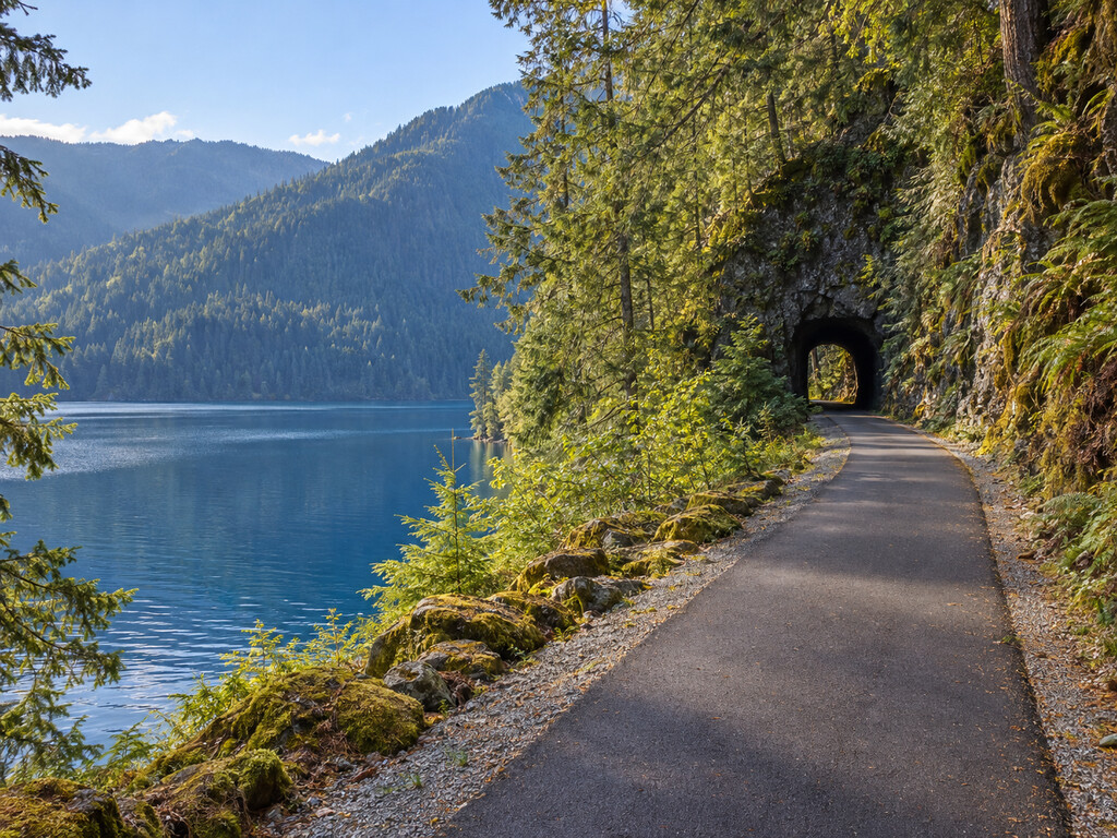
Spruce Railroad Trail traces Lake Crescent’s north shore on a broad, paved former rail grade, linking two named trailheads with lake views, forest, and two restored railroad tunnels. This guide focuses on the practical details: which end to start from, what facilities are verified, what to carry for the tunnels, and how to check access before leaving.
Spruce Railroad Trail at a glance
- Current status: Open from both trailheads as of September 8, 2026, according to Olympic National Park.
- East access: Lyre River Trailhead on East Beach Road.
- West access: North Shore Picnic Area on Camp David Jr. Road.
- Surface: An eight-foot-wide paved multiuse trail with a gravel shoulder, completed as an accessible corridor.
- Signature features: Lake Crescent shoreline, McFee Tunnel, Daley Rankin Tunnel, and the former 1918 railroad grade.
- Best for: Walking, rolling, bicycling, and an out-and-back trip adjusted to your time and comfort.
Choose the right trailhead
The trail is open from both ends, but the two approaches are not interchangeable. Pick your starting point before navigating because the roads reach opposite ends of Lake Crescent’s north shore.
Lyre River Trailhead: the east-end choice
The Lyre River/East Beach Road trailhead is the clearest starting point for visitors who prioritize verified accessible facilities. The Olympic Discovery Trail directory identifies designated accessible parking and accessible pit toilets here. The directory also notes that a long tunnel lies roughly a mile west of the trailhead, making a light useful even for a relatively short outing.
Use the map at the end of this guide for the named Spruce Railroad Trailhead on East Beach Road. Do not rely on a generic “Lake Crescent” destination, which can route you to the south shore instead.
North Shore Picnic Area: the west-end choice
Olympic National Park identifies North Shore Picnic Area on Camp David Jr. Road as the west trailhead, and its current-conditions page confirms that the picnic area is open. This end is useful for approaching the western portion of the rail-trail and the restored Daley Rankin Tunnel.
Facility details can change seasonally, so treat the east trailhead’s explicitly documented accessible parking and pit toilets as the more dependable plan when those features determine your choice.
How long is the trail?
Official descriptions use two different numbers because they describe different pieces of the corridor. The Olympic Discovery Trail directory highlights a four-mile Spruce Railroad Trail segment, while National Park Service project records describe nearly ten miles of completed accessible trail along Lake Crescent’s north shore. Rather than forcing one number onto every itinerary, plan this as an out-and-back from either trailhead and turn around based on daylight, weather, mobility, and the features you want to reach.
The route is not a loop. A full point-to-point trip requires a vehicle shuttle or another arranged pickup. Download or save your route before driving into the Lake Crescent area.
McFee and Daley Rankin tunnels
The restored tunnels are central to the trail’s search appeal and its history. National Park Service records identify the McFee Tunnel as approximately 450 feet long and confirm restoration of the Daley Rankin Tunnel during the final trail-improvement phase.
Carry a headlamp or flashlight even on a sunny day. Tunnel interiors can be dark, cool, and damp, and other users may be approaching from the opposite direction. Slow down before entering, make yourself visible, and avoid stopping where you block the travel lane.
Accessibility and mixed-use etiquette
The finished corridor was designed as a universally accessible, multipurpose trail. National Park Service project documentation describes an eight-foot paved surface with an adjacent gravel shoulder and use by hikers, bicyclists, equestrians, and people using wheelchairs.
“Accessible” does not guarantee identical conditions every day. Leaves, small branches, wet pavement, maintenance activity, or temporary hazards can affect the route. Check current conditions immediately before travel. Faster users should slow near blind curves and tunnels, announce passes, and leave enough space for oncoming traffic.
Railroad history without the guesswork
The grade was built in 1918 to move aircraft-quality spruce during World War I. The war ended before the railroad was complete, and the National Park Service says no Sitka spruce was processed locally for biplanes. The railroad was later completed for other timber activity and abandoned in 1951.
Today, the converted corridor forms a signature portion of the Olympic Discovery Trail. The paved grade, rock cuts, and restored tunnels make the transportation history visible without requiring an off-trail detour.
Lake Crescent safety
- Bring a light: Both tunnel history and current trail guidance support carrying a flashlight or headlamp.
- Expect changing weather: Lake Crescent can shift quickly from calm sun to wind, rain, and cooler temperatures.
- Stay on the developed corridor: Shoreline rocks, steep banks, and wet surfaces can be slick.
- Control speed: The trail serves people moving at very different speeds, especially near tunnels and curves.
- Carry water and essentials: Do not assume seasonal services will be available at either end.
- Check same-day conditions: Road, trail, storm, fire, and maintenance notices can supersede any trip guide.
Build a Lake Crescent day
For another precise Lake Crescent access point, compare the Storm King Boat Launch guide at the lake’s east end or the Fairholme Boat Launch guide at the west end. The broader Olympic National Park visitor guide can help connect this trail with a larger peninsula itinerary.
Keep the day realistic: the north-shore trailheads, south-shore highway stops, and boat launches require different road approaches. One well-planned trail outing is usually more useful than rushing between multiple access points.
Verify conditions before you go
The primary current source is the Olympic National Park Alerts & Conditions page. It specifically identifies whether Spruce Railroad Trail is open from Lyre River/East Beach Road and North Shore Picnic Area/Camp David Jr. Road. For trailhead accessibility and route context, use the Olympic Discovery Trail directory. Historical and construction details come from the NPS project-completion record.
Map: Spruce Railroad Trailhead on East Beach Road
This map targets the named east-end trailhead rather than a general Lake Crescent pin. For the opposite end, navigate separately to North Shore Picnic Area on Camp David Jr. Road.


Leave a Reply