
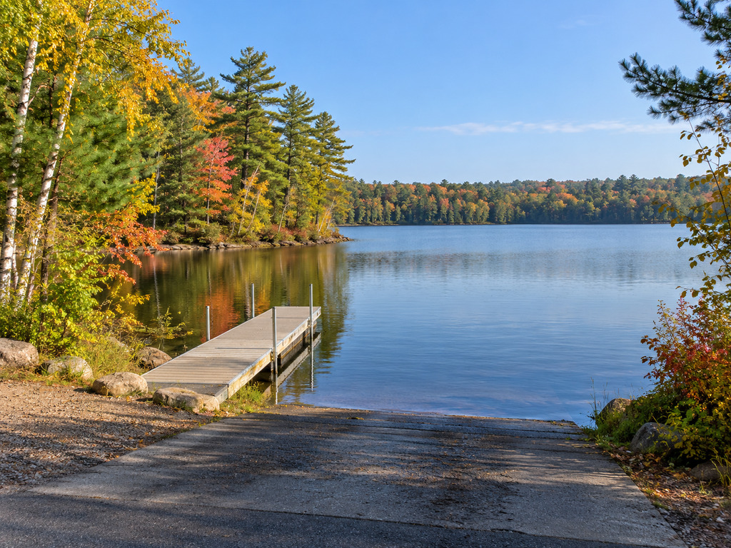
Clear Lake near Manitowish Waters gives paddlers and anglers two very different public access choices: a paved trailer ramp with a boarding dock on Clear Lake Road, and a gated sand carry-in on Haskins Road. Wisconsin DNR currently lists both landings on this 515-acre Vilas County lake, but the older facility records show important differences in parking, launch depth and accessibility.
Clear Lake access at a glance
| Feature | Clear Lake Access | Clear Lake Carry-in Access |
|---|---|---|
| Road | West side of lake off Clear Lake Road | Off Haskins Road |
| DNR record | 1890 | 3360 |
| Coordinates | 46.139397, -89.82363424 | 46.15397565, -89.81585423 |
| Launch | One paved lane; listed depth greater than 3 feet | One unimproved sand launch; listed depth less than 3 feet |
| Dock | Yes | No |
| Parking | 1–5 trailer stalls and 1–5 vehicle spaces | No trailer stalls; 1–5 vehicle spaces |
| Restroom | Portable restroom listed | None listed |
| Best fit | Trailered boats and paddlers who need a firm ramp | Canoes, kayaks and other hand-carried craft |
Which Clear Lake landing should you use?
Choose the Clear Lake Access ramp if you are towing a boat. DNR’s record describes one paved lane, an 8% slope, water deeper than 3 feet at the launch and a boarding dock. The small lot has only 1–5 trailer stalls, so arrive with a backup plan rather than assuming space will be available.
Choose the Clear Lake Carry-in Access for a canoe, kayak or similarly portable craft. DNR describes an unimproved sand launch with shallow water and no dock. A gate blocks trailer access, and the site has no trailer stalls, restroom, potable water, lighting or other utilities listed.
The individual facility records are dated February 2, 2017, while the current Wisconsin DNR boating directory still lists both access points. Treat the measurements and amenity counts as planning guidance, then check posted signs and on-site conditions before launching.
Accessibility and facilities
The paved landing’s dock was designed to be accessible, but DNR says the route of travel to it was not ADA accessible when inspected in September 2012. The agency therefore marks the access as having no ADA-accessible features. The carry-in is also listed with no ADA-accessible features.
Neither access should be treated as a full-service launch. The paved ramp lists a portable restroom but no potable water, fish-cleaning station, lighting or pumpout. The carry-in lists none of those services. Visitors who need a firm, step-free route or current restroom information should confirm conditions with the Northern Highland–American Legion State Forest before traveling.
Fishing Clear Lake
The Wisconsin Lakes record lists Clear Lake at 515 acres with a maximum depth of 45 feet. Musky, panfish, northern pike and walleye are listed as common; largemouth and smallmouth bass are also present.
Review the current Clear Lake fishing regulations before keeping fish. Species seasons, minimum lengths and daily bag limits differ, and posted notices or emergency rules can supersede a trip plan. Carry the required Wisconsin fishing license and clean, drain and dry gear before moving to another waterbody.
Hours, seasons and safety
Wisconsin DNR manages both landings through the Northern Highland–American Legion State Forest. The state forest is generally open from 6 a.m. to 11 p.m. year-round, but ice, snow, high water, maintenance or posted restrictions can affect individual access sites.
- Wear a properly fitted life jacket and check wind conditions before leaving shore.
- At the carry-in, expect to hand-carry gear across an unimproved surface and launch without a dock.
- At the paved ramp, stage away from the lane and do not block the small parking area while loading.
- Use the mapped coordinates to reach the correct access; “Clear Lake” is a common Wisconsin place name.
- Inspect posted rules when you arrive. DNR notes that local ordinance databases may not reflect the newest on-site restrictions.
Do not confuse this Clear Lake with the campground lake
This guide covers Clear Lake in the Town of Manitowish Waters, identified by Wisconsin waterbody ID 2329000. It is not the Clear Lake Campground lake near Woodruff, which is a separate waterbody with different access, rules and coordinates. Matching the waterbody ID and landing coordinates prevents a costly wrong turn.
Nearby Northern Highland alternatives
For a quiet no-motor outing, compare the Crystal Lake small-craft access and the two Firefly Lake carry-ins. If you need more trailer-ramp choices, the Big Muskellunge Lake ramp comparison covers three public options.
Official planning links
- Wisconsin DNR Clear Lake overview
- Wisconsin DNR Clear Lake boating directory
- Clear Lake Access record 1890
- Clear Lake Carry-in Access record 3360
- Current Clear Lake fishing regulations


Leave a Reply