
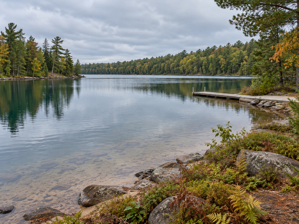
Kentuck Lake has two public launches, but their layouts are dramatically different. The west-side Town of Phelps ramp offers a paved lane and dock with only a handful of parking spaces. The northeast Forest Service access off Tuttle Road has a concrete-panel ramp, dock, vault toilet and much more parking, but the official inventory lists a launch fee and operating hours. This guide compares the verified access records so you can choose before towing to the lake.

Quick choice: which Kentuck Lake launch should you use?
- Choose the Tuttle Road / Forest Service access when trailer parking and a vault restroom matter most, or when you are visiting the campground and state natural area.
- Choose the Kentuck Landing Road ramp when the west side fits your route and you can work with a very small parking area.
- Check the landing signs before launching. The DNR confirms two public landings, but the detailed facility inventories are dated March 28, 2017, and conditions can change.
Kentuck Lake at a glance
Wisconsin DNR identifies Kentuck Lake as waterbody ID 716800, spanning Vilas and Forest counties. The lake covers 1,001 acres, reaches 40 feet at its deepest point and has a mean depth of 13 feet. DNR classifies it as a drainage lake and describes the bottom as 65% sand, 15% gravel and 20% rock. Its mapped center is 45.9852074, -88.9998038.
The agency lists musky, panfish, smallmouth bass and walleye as common, with largemouth bass present. Water clarity is rated low, so anglers should expect conditions unlike the unusually clear lakes elsewhere in Vilas County. A contour map and an offline navigation backup are useful when exploring beyond the launch bay.
Launch comparison
| Feature | Kentuck Landing Road | Tuttle Road / Forest Service |
|---|---|---|
| Official access ID | 2000 | 1948 |
| Coordinates | 45.98480176, -89.01213389 | 45.99316697, -88.98156966 |
| Manager | Town of Phelps | U.S. Forest Service |
| Launch lanes | 1 | 1 |
| Ramp surface | Paved | Concrete panels |
| Listed launch depth | Deeper than 3 feet | Deeper than 3 feet |
| Boarding dock | Yes | Yes |
| Trailer parking | 1–5 spaces | More than 25 spaces |
| Vehicle-only parking | 1–5 spaces | More than 25 spaces |
| Restroom | Vault | Vault |
| Fee / hours in inventory | Not listed | Launch fee; 6 a.m.–10 p.m. |
Kentuck Landing Road: a small west-side ramp
The Town of Phelps launch sits on the west shore at 45.98480176, -89.01213389. The official Kentuck Lake Ramp 1 record lists one paved lane, water deeper than three feet at the launch, a boarding dock and a 13% ramp slope. It also lists a vault toilet but no lighting, potable water, fish-cleaning station or marine pumpout.
The defining constraint is parking: the inventory lists only 1–5 vehicle-and-trailer spaces and 1–5 vehicle-only spaces. That makes this access a better fit for quieter times and visitors already approaching from the west. Have the Tuttle Road launch saved as a backup instead of circling or blocking Kentuck Landing Road when the small lot is full.
DNR’s September 2013 accessibility note says the slope to the boarding dock exceeded the maximum allowed for ADA accessibility, and the record lists no accessible features. Anyone who needs a particular ramp grade or dock route should confirm current conditions with the Town of Phelps before leaving home.
Tuttle Road: the higher-capacity Forest Service access
The northeast access is reached from Tuttle Road off Divide Road at 45.99316697, -88.98156966. The official Kentuck Lake Access 2 record lists one concrete-panel lane, water deeper than three feet, a boarding dock and a 9% ramp slope.
The inventory reports more than 25 trailer spaces and more than 25 vehicle spaces, making this the practical default for most first-time visitors. It also lists a vault restroom, but no lighting, potable water, fish-cleaning station or pumpout. The record says a launch fee is required and gives hours of 6 a.m. to 10 p.m.; because no amount is published in that record and facility policies can change, bring a payment option and check the current sign rather than relying on an old fee.
The 2013 accessibility assessment says the transition to the boarding dock was not accessible, while the restroom was accessible. The record’s overall accessibility field says no. Treat each feature separately and contact the Eagle River–Florence Ranger District if an accessible restroom, route or dock is essential.
Fishing and the 2026–27 rule change
Kentuck Lake supports a mixed Northwoods fish community. DNR lists musky, panfish, smallmouth bass and walleye as common and largemouth bass as present. Match tackle and presentation to the current season, water temperature and visibility rather than assuming one shoreline pattern will work across the entire 1,001-acre lake.
A Kentuck-specific panfish rule took effect for the 2026–27 season: 25 panfish may be kept, but no more than five may be perch. The DNR lists the rule under both Vilas and Forest counties because the lake crosses the county line. Other species retain their applicable statewide or water-specific rules. Always verify the live 2026–27 regulation changes and the current fishing-regulations hub before fishing.
Kentuck Lake State Natural Area
The north shore also protects a 291-acre State Natural Area owned by the U.S. Forest Service. DNR describes an unusual ridge-and-swale landscape where sandy ridges, open bog, conifer swamp, sedge meadow and fen-associated plants occur close together. The agency’s directions start at the Forest Service campground and follow a hiking trail about 0.3 miles northwest along the lakeshore.
This is a sensitive natural area, not a developed park. DNR notes that non-DNR ownership controls allowable activities, access can change and temporary closures may occur. Stay on established routes where possible, leave plants and natural features undisturbed, and review the official Kentuck Lake State Natural Area page plus current Chequamegon–Nicolet National Forest alerts and orders before adding a hike to your boating trip.
Launch-day checklist
- Stage lines, plugs, safety gear and payment before occupying the ramp.
- Wear a properly fitted life jacket and check the forecast; cold autumn water sharply reduces survival time.
- Carry drinking water because neither access inventory lists potable water.
- Expect seasonal dock changes and inspect the ramp edge before backing.
- Read posted local boating notices; DNR warns that online ordinance records may lag local changes.
- Inspect the boat, trailer and equipment; remove plants and animals; drain all water; never move live fish; and dispose of unwanted bait in the trash.
The final invasive-species steps are not optional etiquette. They are part of Wisconsin’s boat transportation and bait laws and should be completed before moving to another Northwoods lake.
Nearby Vilas County alternatives
If Kentuck’s single-lane ramps do not fit your route or rig, compare the two higher-capacity choices in our North Twin Lake launch guide. The South Twin Lake access guide covers a town landing and a Forest Service alternative, while the Trout Lake guide compares three public launches farther west.
Official sources
- Wisconsin DNR: Kentuck Lake overview
- Wisconsin DNR: facts and figures
- Wisconsin DNR: boat landings
- Wisconsin DNR: public boat-access dataset
- Wisconsin DNR: Kentuck Lake State Natural Area


Leave a Reply