
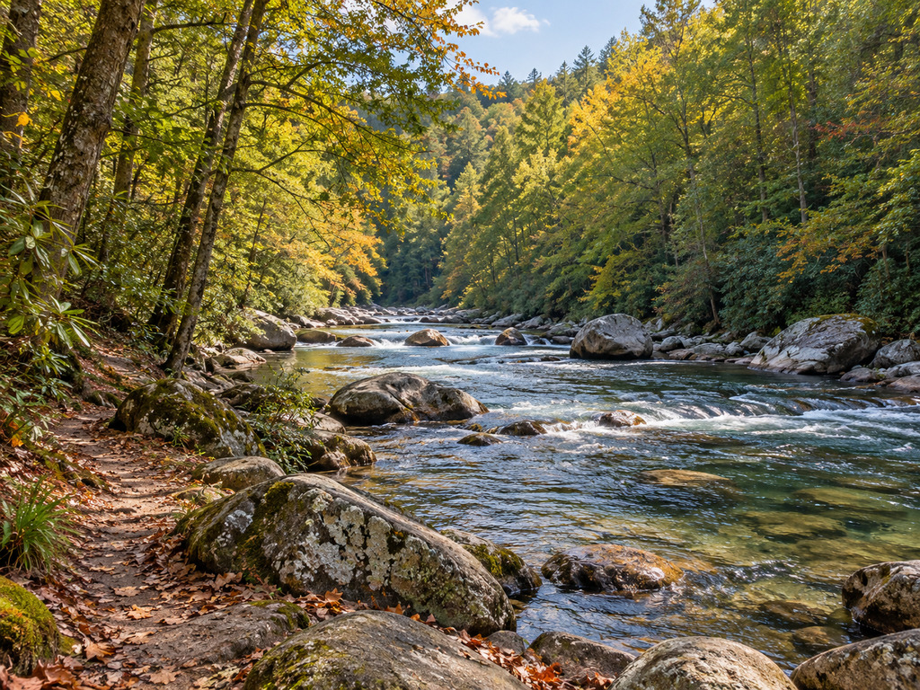

Burrells Ford gives anglers and campers a practical entry to the upper Chattooga River on the Georgia–South Carolina boundary. The federal site is free, open year-round and built around walk-in access rather than drive-up campsites. From the parking area, visitors carry their gear about a quarter mile to individual sites beside the river. The tradeoff is important: there is a vault toilet and picnic tables, but no potable water.
What makes Burrells Ford useful
The official Forest Service listing places the campground where Forest Service Road 646 crosses the Chattooga River. It is open 24 hours a day, charges no fee and allows stays of up to 14 days. Saddle, pack and draft animals are not allowed at the campsites.
This is a simple base for fishing, hiking and riverside camping, not a developed RV campground. Plan to carry all camping equipment from the parking lot, bring drinking water and pack out everything you bring. The Forest Service page does not list an advance-reservation system or a guaranteed site count, so contact the Andrew Pickens Ranger District at 864-638-9568 if site availability or conditions will determine your trip.
Fishing the Chattooga near Burrells Ford
The Chattooga is a cold, fast mountain river with pools, runs and boulder-strewn pocket water. South Carolina DNR’s trout guide describes the area around Burrells Ford Bridge and the campground as stocked water, while the upper headwaters also support wild brown trout. A current SCDNR weekly stocking summary recorded the Chattooga River and East Fork of the Chattooga River on September 23, 2026.
A stocking report confirms agency activity, not where fish will hold on a later date. Rainfall, water temperature, river level and angling pressure can change conditions quickly. Fish methodically, avoid trampling bankside vegetation and release fish with wet hands when release is required or intended.
Do not confuse this water with the delayed-harvest reach
Georgia’s delayed-harvest section of the Chattooga runs from the Georgia Highway 28 bridge upstream to the mouth of Reed Creek. Burrells Ford is farther upstream, so the campground water is not automatically governed by that downstream delayed-harvest designation. The current Georgia trout regulations require immediate release and artificial lures with one single hook per lure on the designated delayed-harvest section from November 1 through May 14.
Regulations can differ by reach, bank and tributary. Confirm your exact position before fishing, and never extend the main-stem rule or license agreement to a tributary without checking that tributary’s rules.
Georgia–South Carolina reciprocal license
South Carolina DNR states that a valid freshwater sport-fishing license and applicable permits from either Georgia or South Carolina may be used on the Chattooga River up to the North Carolina boundary under the two-state reciprocal agreement. The agreement covers the river’s main channel, not tributary streams. Review the official reciprocal-license explanation and the current limits before fishing.
Current upper-corridor group restrictions
A Forest Service order effective April 22, 2025 through April 22, 2027 limits groups in much of the upper Chattooga corridor to six people while camping, four while fishing and 12 while hiking. The order includes specific exemptions near Burrells Ford Road: fishing and hiking groups within a quarter mile of the road are exempt, and camping groups within a quarter mile downstream are exempt. Do not assume that exemption follows you farther into the corridor.
Parking, access and facilities
- Official coordinates: 34.96900499, -83.11813303.
- Road: Forest Service Road 646 at the Chattooga River.
- Campground approach: approximately 0.25 mile on foot from the parking lot.
- Cost: no campground fee.
- Facilities: vault toilet and picnic tables.
- Water: no potable water; bring enough for drinking, cooking and cleaning.
- Operating period: listed as open year-round and 24 hours a day.
- Maximum stay: 14 days.
Download directions and maps before entering the forest, and check the current Francis Marion and Sumter National Forest alerts. At the October 8, 2026 verification, the alert list did not name Burrells Ford Road or the campground as closed, but road conditions can change after storms or maintenance.
Trails and nearby options
The Chattooga Trail passes the campground and provides access along the river corridor. Longer outings enter remote terrain near the Ellicott Rock Wilderness, where navigation, water treatment, weather preparation and group-size rules matter more than they do near the parking area.
For a developed stocked-water campground in the same regional network, compare the Tallulah River guide. The Cooper Creek WMA guide covers another fishing-and-camping base, while the Noontootla Creek guide focuses on a more restrictive wild-trout setting.
Safety and low-impact camping
- Bring drinking water and a reliable treatment method for emergencies; never assume untreated river water is safe.
- Check rainfall and river conditions. Swift water, slick rocks and changing levels can make wading dangerous.
- Carry camp gear in containers you can manage for the quarter-mile walk from the parking area.
- Store food securely, keep a clean campsite and follow current fire restrictions.
- Use established sites and trails to protect fragile riverbanks and wilderness vegetation.
- Save the ranger-district number and tell someone your route and expected return time before entering remote trail sections.
Bottom line
Burrells Ford is valuable because it combines free walk-in camping, direct Chattooga River access and a river trail at one official public site. It is also intentionally simple: no potable water, no drive-up campsite and no substitute for checking the exact fishing reach. Arrive self-sufficient, respect the current group order and use the official coordinates rather than an informal roadside pin.


Leave a Reply