
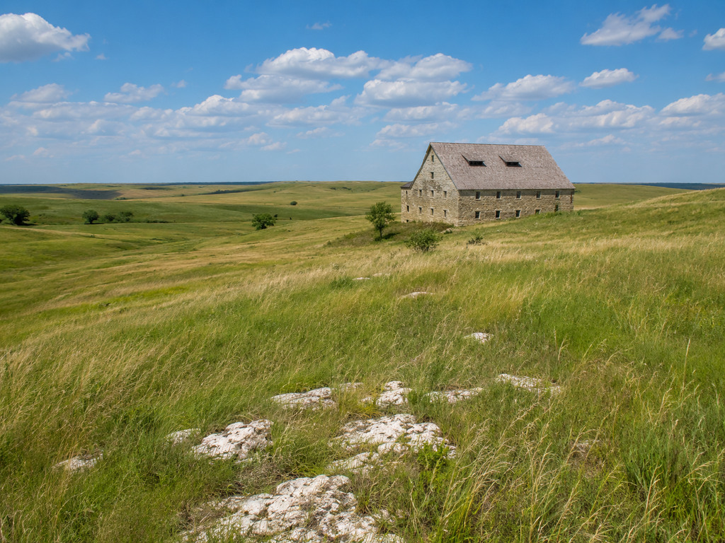
Tallgrass Prairie National Preserve protects a rare sweep of Flint Hills grassland near Strong City, Kansas, along with the historic Spring Hill Ranch. A visit can be as easy as touring the limestone ranch buildings and a short nature trail, or as ambitious as a full day on the preserve’s open-country hiking network.
Tallgrass Prairie National Preserve at a glance
- Address: 2480B KS Highway 177, Strong City, Kansas 66869
- Entrance: Free; no entrance pass or reservation required
- Preserve access: Prairie trails are generally open 24 hours, year-round, subject to temporary closures
- Main activities: Hiking, prairie and bison viewing, ranch history, ranger programs and catch-and-release pond fishing
- Camping: Not permitted; overnight parking is also prohibited
- Visitor center phone: 620-273-8494, extension 270
Getting there and parking
The preserve entrance is on K-177, the Flint Hills National Scenic Byway, about two miles north of the U.S. 50 junction near Strong City. Watch for the brown attraction signs and turn directly into the visitor-center entrance. K-177 is a 60 mph highway with blind hills, truck traffic and no usable shoulder, so do not park or walk along the highway.
The National Park Service lists four parking lots and five hiking trailheads. The visitor-center lot holds the most vehicles, includes five accessible spaces during business hours and permits buses and trailers to pull through. Holiday weekends can be busy, but parking is usually ample at other times.
Start at the visitor center and ranch
Begin at the visitor center for a trail map, current closure information and advice about bison locations. Inside are restrooms, water fountains, exhibits, a short orientation film, a bookstore and Junior Ranger activities. The nearby Spring Hill Ranch complex includes the historic limestone house, three-level barn and outbuildings that explain the region’s cattle-ranching story.
Building hours are seasonal. The current NPS schedule lists the visitor center and historic buildings from 8:30 a.m. to 4:30 p.m. May 1 through October 31, and 9 a.m. to 4:30 p.m. November 1 through April 30. From November through March, the visitor center is closed Monday and Tuesday. Major holidays, winter weather, staffing and ranch operations can also affect access, so check the official hours page before a long drive.
Choose a short walk or a backcountry hike
Three nature trails keep visitors closer to parking and services. The Bottomland Trail is the best starting point for an easier outing: NPS describes its half-mile and three-quarter-mile options as wheelchair friendly except when wet, with interpretive waysides, benches, a picnic area and an accessible comfort station. Its gravel parking area is close to the trailhead.
For a longer day, the preserve offers about 40 miles of backcountry trails on old ranch roads and mowed grass paths. Published routes range from roughly 3.8 to 13 miles and cross exposed, rolling terrain with creek dips, loose limestone and very little shelter. No hiking permit is required. Download the current NPS trail map, note your trailhead and turnaround time, and expect slower travel after rain.
When to see tall grass and wildflowers
The prairie changes dramatically through the year. Spring brings short new growth and early wildflowers; summer adds heat, insects and increasingly tall vegetation. NPS notes that grasses generally reach their maximum height in late September and October, when the hills often shift toward gold and copper. Winter offers wider views but can bring strong wind, ice and sudden cold.
Prescribed fire is part of prairie management, especially around spring and fall. Fire operations, bison work and cattle activity can temporarily close trails. Treat posted closures as firm and check current conditions before starting a long loop.
Bison safety
Bison use Windmill Pasture and sometimes West Traps Pasture, and several hiking routes pass through their range. Follow the current NPS minimum of 125 yards. If bison occupy the trail, make a very wide detour only when it is safe and permitted, or turn around. Never approach, feed or attempt to photograph them at close range.
- Do not run through a bison pasture or turn your back on a nearby animal.
- If a bison changes direction, raises its tail or reacts to you, increase your distance immediately.
- Use the metal hiking gates; never cross an electrified barbed-wire fence.
- Pets are prohibited in bison areas and most backcountry trails.
Pets, bikes and other trail rules
Leashed pets are allowed in parking and picnic areas, around the outside of historic buildings, and on designated nature trails including Fox Creek, Z Bar Spur, Bottomland and Southwind. The Two Section Trail is only seasonally pet-friendly when cattle are absent. Pets must remain on a six-foot leash and cannot enter buildings, bison pastures or most backcountry trails.
Preserve trails are for foot travel. Bicycles, e-bikes, motorized vehicles and horses are not allowed on the hiking network. Camping, open flames, grilling and drones are prohibited. The preserve also prohibits overnight parking.
Accessibility and facilities
Accessible parking is available at the visitor center around the clock, and accessible restrooms are available inside the center and in its after-hours breezeway. Additional accessible restrooms are near the ranch headquarters. The historic house’s main level is reached by a concrete walkway and ramp.
Visitors with visual impairments can ask about Trekker Breeze+ handheld GPS units for the trail system and ranch site; units must be returned by 4 p.m. The orientation film is open-captioned, audio description and a hearing loop are available, and the visitor center offers tactile exhibits and a Braille brochure. Conditions can affect outdoor accessibility, so call ahead when a particular feature is essential.
Weather and practical safety
- Carry water in every season; shade is scarce and summer temperatures can exceed 90°F.
- Check radar before leaving the trailhead. Thunderstorms, high winds and lightning develop quickly over exposed prairie.
- Wear sturdy footwear. Mowed grass and ranch roads become slick and muddy after rain.
- Use sunscreen and insect repellent, and check for ticks after warm-weather hikes.
- Watch for poison ivy and venomous snakes; do not reach into tall grass, rock walls or unseen gaps.
- Download or photograph the trail map before leaving the visitor center because mobile service can be unreliable.
Where to camp nearby
There is no campground inside the preserve. NPS directs campers to city parks in Cottonwood Falls, about five miles south, and also lists Chase State Fishing Lake and Council Grove Reservoir as nearby alternatives. Verify current rules, fees and site availability with the managing agency before depending on any campground.
More Flint Hills adventures
Use Tallgrass Prairie National Preserve as the anchor for a broader Flint Hills trip. These guides cover distinct trailheads, fishing waters, campgrounds and outdoor-history stops:
- Trail access: Council Grove trailhead and Admire trailhead
- Fishing and boating: Chase State Fishing Lake, Lyon State Fishing Lake and Council Grove City Lake
- Camping near Council Grove Lake: Canning Creek Campground and Santa Fe Trail Campground
- Outdoor history: Kaw Mission State Historic Site
Plan with the official source
Before your visit, check the official Tallgrass Prairie National Preserve planning page for current conditions, building hours and closures. The NPS backcountry trail guide, safety page and accessibility guide are especially useful for choosing a route that fits your group.


Leave a Reply