
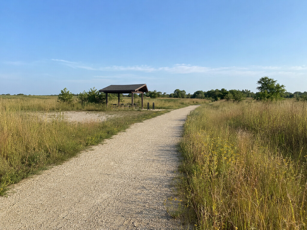
The Admire trailhead gives walkers, cyclists and horseback riders a small-town access point to Flint Hills Trail State Park in Lyon County, Kansas. It is a practical stop for parking, refilling water in warm weather and making simple bike repairs, but it is not a campground. Use this guide to find the access point, understand its verified facilities and plan for prairie weather.
Admire trailhead at a glance
- Official name: Admire Rest Area, Flint Hills Trail State Park
- Access: parking at Fourth and Main streets in Admire
- Official coordinates: 38.641175, -96.104267
- Allowed uses: walking, hiking, cycling and horseback riding; motorized travel is not allowed
- Verified facilities: trail access and parking, vault toilet, one shelter, bike-fixing station and a water fountain operating during warmer months
- Camping: not available at this rest area
- Permit: KDWP says no permit is required to use the trail
How to reach the Admire access point
The Kanza Rail-Trails Conservancy identifies the Admire parking location at Fourth and Main streets. KDWP publishes the rest-area coordinates as N 38° 38′ 28.23″, W 96° 6′ 15.36″, which convert to approximately 38.641175, -96.104267. Use the intersection and the final map below together rather than relying on the state park’s general Osawatomie mailing address.
Park only in the designated area and keep the trail corridor open for maintenance and emergency vehicles. The official sources do not publish a space count or promise oversized-trailer capacity at Admire, so riders hauling horses should verify current conditions with KDWP before making the trip.
What facilities are available
KDWP’s Admire Rest Area record lists a vault toilet, one shelter, a bike-fixing station and a water fountain that operates during warmer months. The department’s current trail alert says the Admire restroom and fountain are on for the season as of August 23, 2026. Seasonal water can still be shut off for maintenance or cold weather, so carry enough water to finish your outing even when you expect the fountain to work.
There is no camping at this rest area and no reservable campsite. Treat the shelter as a short rest stop rather than an overnight facility. No official source reviewed for this guide confirms food service, showers, electrical outlets or a staffed office at the trailhead.
Choose a walk or ride from Admire
Flint Hills Trail State Park follows a former Missouri Pacific railroad corridor, so grades are generally gentler than purpose-built hiking trails. The route is open to foot, bicycle and horse traffic. Surface quality can vary, however, and KDWP notes that sections remain under development. Expect aggregate trail, road crossings and conditions that can change after storms.
For a first visit, choose an out-and-back distance that leaves a generous water and daylight margin. Turn around before fatigue or heat makes the return difficult. Long-distance riders should consult the current official trail map and verify which adjoining segments are open and improved instead of assuming the full signed corridor is continuously developed.
Accessibility and surface expectations
KDWP says the trail is accessible for electric wheelchairs in many locations, but it has not posted site-specific accessibility details for Admire. That broad statement does not confirm the grade, firmness, cross-slope or clear width of every parking transition and nearby segment. Contact the park before traveling if a particular surface or mobility feature is essential.
After rain, crushed-limestone surfaces may soften or hold mud. Summer vegetation can narrow the usable edge, and freeze-thaw cycles may create ruts or ice in colder months. A hybrid, gravel or mountain bike is usually a more conservative choice than narrow road tires on variable aggregate.
Prairie weather and trail safety
- Start early during hot weather and carry more water than the planned distance appears to require.
- Monitor thunderstorms; leave exposed prairie when lightning threatens.
- Use sun protection and tick repellent, then check clothing and skin after the trip.
- Cyclists should carry a helmet, pump, tube or patch kit and basic tools even though a repair station is present.
- Download the current map before departure because mobile service may vary.
- Slow at every road crossing and never assume drivers will yield.
Share the trail safely
Keep right, announce passes and give horses extra room. Cyclists should approach riders slowly and wait for a clear signal before passing. Keep dogs controlled, pack out waste and stay within the public trail corridor; adjoining fields and fences may be private property. Motorized recreation is not permitted on the trail.
More Flint Hills trip ideas
For another exact access point, compare the Council Grove trailhead guide. Anglers can plan a separate outing at Lyon State Fishing Lake, while hikers looking for open prairie can use the Tallgrass Prairie National Preserve guide.
Check current official information
Review the official KDWP Flint Hills Trail State Park page immediately before the trip for active alerts, seasonal amenities, construction and the latest map. The official Admire Rest Area record provides the exact coordinates and facility inventory. Conditions and water availability can change after this article’s August 23, 2026 verification date.


Leave a Reply