
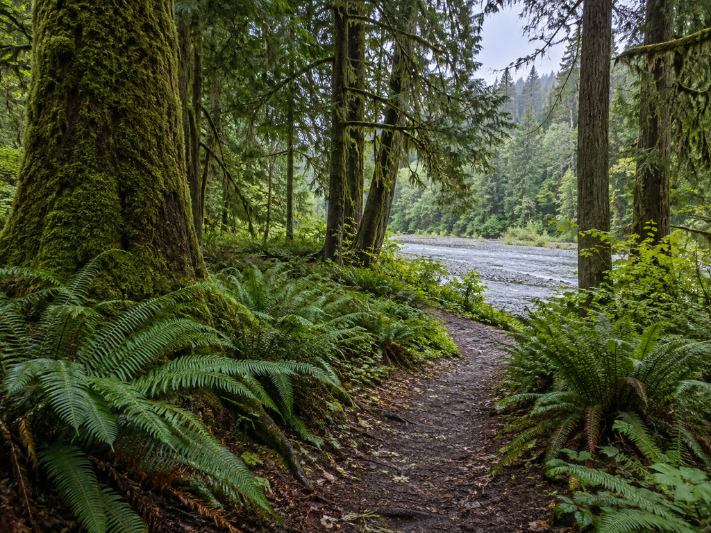
Bogachiel State Park is a compact temperate-rainforest campground beside the Bogachiel River, about six miles south of Forks on Highway 101. Its short park paths offer an easy way to reach the riverside without committing to the separate Bogachiel River backcountry trail. The key current planning issue is water: an official State Parks notice limits potable water to registered campers and tells day-use visitors to bring their own. This guide separates the campground, river access and distant national-park trailhead so you arrive at the right place with the right supplies.
Bogachiel State Park quick facts
- Address: 185983 Highway 101, Forks, WA 98331
- Park hours: 8 a.m. to dusk, year-round
- Setting: Mossy Olympic Peninsula rainforest on the Bogachiel River
- Day-use parking: Discover Pass required
- Current water planning: Day-use visitors should bring all drinking water
- Registered campers: Limited potable water is reserved for registered campers
- Closed water-dependent facilities: Showers, dump station and RV tank-filling station
- Restrooms: Remain open under the official limited-water notice
- River access: Short paths from the state park; conditions vary with rain and river level
- Important distinction: This is not the Olympic National Park Bogachiel River Trailhead
Start with the official Bogachiel State Park page and recheck alerts before leaving Forks. The park’s address and hours were verified September 12, 2026.
Bring water for day use
Washington State Parks’ official limited-water notice says low well levels restrict potable water to registered campers. Day-use visitors are asked to arrive with their own supply. Restrooms remain open, but showers, the dump station and the RV tank-filling station are closed until the well recovers after sufficient fall rain.
The notice was originally published August 14, 2025 and remained the relevant posted water alert during verification on September 12, 2026. Because recovery depends on rainfall and maintenance, treat the alert as something to confirm rather than a permanent facility description. RV travelers should fill tanks and plan a dump-station alternative before turning onto the peninsula’s west side.
Use the Highway 101 state-park entrance
The state park entrance is at 185983 Highway 101, south of Forks. From Forks, follow U.S. 101 south for roughly six miles and watch for the signed entrance. The campground and day-use river paths begin inside this state-managed property.
Cell service can be inconsistent on the western Olympic Peninsula, so save the address and official map before driving. Highway traffic moves quickly; use the signed entrance instead of slowing abruptly or attempting an informal roadside pullout.
The campground has 42 numbered sites
The official Bogachiel campground map lays out 42 numbered campsites in two forested loops, plus a group-camp area, day-use facilities and paths toward the river. Site dimensions, hookups and availability differ, so choose through the official reservation system rather than assuming every site fits the same tent, trailer or motorhome.
- Bring drinking water even if you have a reservation; camper supply is currently limited.
- Do not count on the shower, dump station or RV fill station while the alert remains active.
- Check the exact campsite length and utility details before booking.
- Expect damp ground, heavy shade and frequent rain even when Forks has a dry forecast.
- Store food securely and keep the campsite free of scented items overnight.
Short river access is inside the park
Bogachiel State Park’s appeal is its direct relationship to the river. Short natural-surface paths pass through sword ferns, mossy trunks and dense conifers toward the bank. These are useful for a brief walk, quiet river viewing or a campground break, but they are not engineered waterfront promenades. Roots, mud, wet leaves and changing bank edges are normal.
River level and current can rise quickly after rain in the Olympic Mountains. Stay back from undercut banks, keep children close, and do not enter swift or discolored water. A gravel bar that looks accessible during low flow can disappear as the river rises.
Do not confuse it with the Bogachiel River Trailhead
The similarly named Bogachiel River Trail is a separate national-park backcountry route reached from the Undi Road system east of Highway 101. It does not start in the state-park campground. Drivers looking for the long trail can easily stop at the wrong property if they navigate only to “Bogachiel.”
The National Park Service trail guide describes remote camps, untreated river water, bear-canister requirements and difficult navigation on upper sections. Those backcountry requirements are not a description of the state park’s short campground paths. Choose the state-park address for camping and simple riverside access; use the NPS instructions only for a properly prepared backcountry trip.
Fishing requires a same-day regulation check
The Bogachiel River is regulated water, and seasons, legal methods, retention rules and emergency actions can change by reach and date. A state-park path reaching the bank does not mean a species is open or that every stretch is fishable. Check the current WDFW fishing regulations and emergency rules immediately before fishing.
Carry the required Washington license and identify your exact river reach before rigging. Avoid redds, respect closures and private-property boundaries beyond the park, and never use an old blog post as the controlling regulation. This guide confirms access planning, not an open harvest season.
Passes, hours and day-use planning
- Discover Pass: Required for day-use vehicle parking; Washington’s current base prices are $10 for one day or $45 annually, before any transaction fee.
- Hours: 8 a.m. to dusk year-round.
- Water: Bring your own for day use while the official alert remains active.
- Footwear: Waterproof shoes with reliable traction suit the damp forest paths.
- Weather: Carry rain protection and an insulating layer even on a short stop.
- Pets: Keep pets leashed and under control; national-park trail rules differ if you continue elsewhere.
Camping fees do not replace the need to follow reservation terms, site limits and current facility notices. Confirm campsite availability and any fire restrictions with Washington State Parks before arrival.
Safety in a wet rainforest campground
- Never stand on an undercut riverbank or wet log above moving water.
- Turn around if a path becomes flooded, unstable or difficult to follow.
- Treat every natural water source; limited campground water is not permission to drink from the river.
- Keep wildlife wild—do not feed animals or leave food unattended.
- Use reflective gear or a light near campground roads in dim forest conditions.
- Check current road, smoke and weather alerts before a long drive to the peninsula.
Nearby Olympic Peninsula options
Bogachiel works well as a quieter base near Forks, but it serves a different intent from the area’s launch, beach and national-park destinations. For a broader orientation, use the Olympic National Park planning guide. For exact water access farther north, the Lake Ozette launch and fishing guide covers two developed launch areas and lake-specific rules.
If the limited-water facilities do not fit your camping setup, compare another official campground before driving. Do not assume nearby federal, tribal and state properties share the same pass, pet, fire or reservation rules.
Plan the simple visit Bogachiel does best
Bogachiel State Park is most useful as a forested campground and short riverside stop at the edge of Forks—not as a substitute for the remote national-park trail. Save the exact Highway 101 address, bring water for day use, expect closed showers and RV water services while the alert remains active, and keep a safe distance from the river. That preparation leaves more time for the park’s real payoff: a straightforward walk through moss, ferns and towering coastal forest.


Leave a Reply