
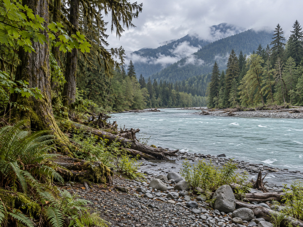
The Hoh River launch near the South Fork confluence is a precise Olympic National Park access point with an unusually strong warning attached. NPS permits fishing from a boat downstream from this launch, yet its Hoh guidance says swimming and boating can be extremely dangerous and are not recommended. This guide keeps those facts together so legal access is never mistaken for easy water.
Hoh River South Fork launch quick facts
- Official location: One-half mile from the park boundary near the South Fork confluence
- Approach: Upper Hoh Road near the Hoh Rain Forest entrance station
- Boat-fishing reach: Downstream from the NPS-defined launch
- River: Class II–III with frequent logjams
- 2026 season: June 1–November 15
- Gear here: Fly fishing only with a barbless single-point hook
- Facilities: Not reliably specified; do not assume a ramp, dock or trailer lot
Start with the official NPS boating directory, the controlling source for this launch and boundary.
Find the correct South Fork access
NPS places the launch one-half mile from the park boundary near the South Fork confluence and identifies a popular Hoh put-in near the entrance station on Hoh River Road. Use the entrance station as the approach reference, then confirm the river entry with park staff and the official Hoh map before unloading.
NPS does not publish ramp material, parking capacity, dock availability or trailer limits here. Channels and gravel bars move. If the trip depends on trailer access, call 360-565-3130 and be prepared to decline the launch.
Know the boat-fishing boundary
Fishing from a boat or raft is permitted downstream from the South Fork launch and along the coastal Hoh. Do not infer upstream permission. Motorized operation is listed only for the coastal portion, not this upper reach. Verify propulsion rules, the full route and the takeout jurisdiction before launching.
Land ownership changes downstream. A visible gravel bar or pullout does not establish public access, legal parking or permission to land.
Follow the 2026 Hoh fishing rules
The 2026 park regulations open the Hoh and South Fork Hoh from June 1 through November 15. From one-quarter mile below Hoh Campground to the park boundary—which lies below the South Fork confluence—the rule is fly fishing only with a barbless single-point hook.
- Release all species except up to two adipose-clipped hatchery steelhead where allowed.
- Release wild fish unless the current chart expressly allows otherwise.
- Bull trout and Dolly Varden may not be targeted or retained.
- Fish only from one hour before sunrise to one hour after sunset.
- Do not project this rule past November 15; winter rules are issued separately.
Recheck the official chart and posted emergency notices on the day you fish.
Carry the required catch record card
A Washington recreational fishing license is not required for freshwater fishing inside Olympic National Park. Anyone fishing for salmon or steelhead—including children—must still carry the free Washington catch record card. Retained fish require the correct location code and entry.
State or tribal reaches downstream may use different licenses, seasons, gear and limits. Plan the whole float, not only the put-in.
Take the NPS danger warning literally
The official Hoh brochure says river swimming and boating can be extremely dangerous and are not recommended. NPS rates the river Class II–III and warns of frequent logjams. Whole trees, root wads, cold swift current and shifting gravel channels can remove escape options quickly.
The allowance defines a regulatory boundary; it is not a safety certification. This is not a beginner float or casual family paddle. If the group cannot read channels, scout bends and arrange a verified takeout, choose bank access or calmer water.
Scout every logjam
- Stop well upstream of bends or wood you cannot see through.
- Scout only from a stable, lawful landing.
- Never assume last season’s channel remains passable.
- Give sweepers, root wads and submerged logs exceptional room.
- Wear a properly fitted personal flotation device at all times.
- Carry throw lines, dry insulation, repair gear and a remote communication plan.
NPS tells boaters to check flows and ask a ranger about closures. The USGS Highway 101 gauge 12041200 is useful context, but it cannot reveal a new logjam or guarantee a navigable route.
Do not assume launch amenities
The NPS directory verifies a launch but not a developed ramp, dock, water, restroom or designated trailer parking at the river entry. Current conditions say Hoh Rain Forest parking areas and restrooms are open; that area-wide statement is not a facility list for this access.
Keep gates, shoulders and emergency routes clear. Summer entrance waits can reach two hours, and NPS recommends arriving before 8 a.m. or after 5 p.m. Preserve daylight for inspection and the shuttle.
Plan for cold water and rapid change
Olympic National Park warns that its waters stay below 50°F. Dress for immersion, protect spare layers in a waterproof bag and keep the group close enough to respond. Mountain rain can change the Hoh while the launch remains dry.
Recheck weather, upstream rainfall, river data and park conditions immediately before departure. Cancel for rising water, poor visibility, unscoutable wood or a skills mismatch.
Do not confuse the three Hoh access points
- South Fork boundary launch: Upper boundary NPS names for downstream boat fishing.
- Hoh Campground put-in: Separate Class II put-in farther inside the park.
- Visitor-center area: Developed campground and trailhead zone at the road’s end—not this launch.
Use the entrance station as an approach landmark and verify the river entry before moving equipment. The map points to that approach rather than inventing a street address for the launch.
Nearby alternatives and final check
For regional logistics, use the Olympic National Park planning guide. If moving-water boating is inappropriate, the Bogachiel State Park guide covers short riverside access near Forks.
- Confirm the Hoh area is open.
- Read the current fishing chart and posted notices.
- Verify the launch and lawful takeout with a ranger.
- Check flow, recent rain and weather.
- Inspect access without blocking the road.
- Scout the first channel and every downstream logjam.
- Carry the catch record card for salmon or steelhead.
- Cancel when the route, wood or group experience creates doubt.
The Hoh below the South Fork supports a precise boat-fishing plan only when the rule boundary, route and hazards are understood together. Let changing wood and current decide whether the trip proceeds.


Leave a Reply